On Saturday, September 28, over 50 participants took an early fall stroll through the Tenleytown commercial district with the Coalition for Smarter Growth and Ward3Vision to learn about the community’s past, present and future.
Category: District of Columbia

CSG Chat: The Future of Metro – the Momentum Plan
WMATA’s Momentum program could be one of the most important transit initiatives for our region in decades. What does the plan include? How will it help Metro to become more reliable? What obstacles do we need to overcome to succeed? How are we going to pay for it? Watch the full video from this live interactive webchat with WMATA’s Shyam Kannan.
STATEMENT on DC Department of Transportation’s New Visitor Parking Pass Program
FOR IMMEDIATE RELEASE
AUGUST 8, 2013
CONTACT: Cheryl Cort, (202) 251-7516 – cell
WASHINGTON, D.C. — The District Department of Transportation (DDOT) announced today that the Visitor Parking Pass (VPP) program will be available District wide to all Residential Parking Permit (RPP) eligible households and those in ANCs 1A, 1B and 1C. Click here to read DDOT’s announcement.
“Giving away something for free that is very valuable and in limited supply inevitably leads to conflict and frustration,” said Cheryl Cort, Policy Director for the Coalition for Smarter Growth. “DDOT’s plan to give out free visitor passes will increase demand for curbside parking in areas where it is already high. A better approach for high demand areas is to fairly price this valuable privilege so that residents, their guests and others would have parking available when they need it,” said Cort.
This decision demonstrates that DDOT needs to step up its efforts to completely reassess the Residential Parking Permit program. We call on DDOT to reset its residential parking management policies before making more individual decisions about public street parking privileges that don’t necessarily serve residents or the city well. A comprehensive approach includes tailoring to the needs and characteristics of different neighborhoods, and using pricing to efficiently manage valuable curbspace where it is scarce.
About the Coalition for Smarter Growth
The Coalition for Smarter Growth is the leading organization in the Washington D.C. region dedicated to making the case for smart growth. Its mission is to promote walkable, inclusive, and transit-oriented communities, and the land use and transportation policies needed to make those communities flourish. To learn more, visit the Coalition’s website at www.smartergrowth.net.
###
Proposed D.C. Zoning Code Re-Write Sparks Debate
 The first major re-write of Washington’s zoning code since it was established in 1958 is expected to be submitted by the Office of Planning today, ending six years of work and triggering another lengthy public process before the District’s Zoning Commission, which will have the final say on new zoning policies.
Among the most controversial proposals is the effort to make D.C. less car-dependent by eliminating mandatory off-street parking space minimums in new development in downtown D.C. Planning Director Harriet Tregoning had also proposed to eliminate parking minimums in transit corridors, but recently changed her position to only reduce those minimums.
Tregoning’s change has left advocates on both sides of the debate unhappy.
“We’re encouraged that there’s not going to be an absolute rule that there will be no parking minimums. We think that’s a step in the right direction, but we are still very concerned because the planning director of the District of Columbia has shown her hand. She, for whatever reason, does not believe there is a parking issue throughout much of the District,” said AAA MidAtlantic spokesman Lon Anderson.
“We are disappointed the city has listened to the opposition to progressive reforms and is backing down on the important reform of removing parking minimums in areas that are well served by transit. The proposal would address a number of the biggest problems with parking minimums but we still maintain that parking minimums are not the right approach to building a more affordable, sustainable city,” said Cheryl Cort, the policy director for the Coalition for Smarter Growth.
At the heart of the controversy lies the question: how much parking does a growing, thriving city need as developers continue to erect new housing, office and retail space near Metro stations, in bus corridors, and downtown D.C. The alleged scarcity of parking spaces today is a common complaint of motorists, but those who favor dumping the parking minimums say residents and visitors will have adequate alternatives to automobile ownership, like car-sharing services, Metro rail and bus, and Capital Bikeshare. Smart growth advocates also point out developers will still be able to build parking if the market demands it, but the decision will be left to them, not decided by a mandate.
“We’re building a lot of parking that generates a lot of traffic, undermining the best use of our transit system,” Cort said.
“We spent the last 100 years building our society to be automobile dependent and then to try to change that in a very short period of time is really imposing an awful lot in a region that is still very, very dependent on the automobile,” counters Anderson.
About 38 percent of all D.C. households are car-free, according to U.S. Census data.
Photo courtesy of AP Photo/Michael Dwyer. Copyright 2013 by WMAL.com. All rights reserved.
D.C. planners drop proposal to end minimum parking rule for developers
Bowing to vocal opposition, District planners have backed off a controversial proposal to eliminate long-standing requirements that developers in some areas include parking spaces in their projects.
The decision not to wholly abandon “parking minimums” in outlying neighborhoods served by Metrorail and high-frequency bus lines comes as planners prepare to submit a wholesale rewrite of the city’s zoning code for approval by the Zoning Commission and shortly after opponents repeated their concerns at a council hearing.
The elimination of parking requirements in “transit zones” had been promoted zealously by Harriet Tregoning, director of the Office of Planning, and her deputies as a necessary response to a city growing more populous and less car-dependent. But residents in some neighborhoods viewed the proposal skeptically, claiming it was based on unfounded assumptions and would only worsen the scarcity of curbside parking.
Tregoning disclosed the change during an interview Friday on WAMU-FM, where she acknowledged she had got “a lot of feedback” about the parking changes. “It’s certainly in response to what we’ve heard from a lot of people,” she said.
In a subsequent interview, Tregoning said the planning office still intended to pursue elimination of parking minimums downtown and in fast-growing, close-in neighborhoods such as the Southwest Waterfront and NoMa. But in other areas eyed for the change, she said, the minimums would be “substantially” reduced rather than eliminated entirely.
“A lot of people were very, very concerned with the concept of no parking minimums,” she said. “I wanted to take that out of the discussion so we could focus on what is reasonable.”
Opponents “seemed to be really hung up by what they perceived as an ideological position,” she added. “I’m not an ideologue. I’m very practical. The practical effect is not very different.”
For a multi-unit residential building under the new proposal, Tregoning said, developers would have to create one parking space for every three units in most areas. They could also apply to the Board of Zoning Adjustment for a “special exception” to the minimum. Under current rules, the minimums vary but often require one space for every two units.
The zoning rewrite is nearing the end of a five-year process that has included discussions about liberalizing rules for “accessory” apartments and corner stores in residential neighborhoods. But the parking debate emerged over the past several months as by far the most contentious point of discussion, generating push-back from several neighborhood groups and AAA Mid-Atlantic.
The decision to back off the elimination of parking minimums vexed a group of activists who view it as a cornerstone of efforts to make the city denser and more transit-oriented.
Stewart Schwartz, executive director of the Coalition for Smarter Growth, which had rallied support for the measure, said Sunday it was “disappointing” to see Tregoning ease off a measure that could have helped make housing more affordable by lowering development costs.
“I think it would have been much simpler and effective” to eliminate the minimums and allow the market to dictate how much parking developers provide, he said, adding that “we’ll still call for the cleaner, market-based approach” at the Zoning Commission.
Some leading skeptics of the original proposal said it was too soon to tell if the revised parking-minimum measures would prove acceptable.
“It’s fine, but I’m not sure it goes far enough,” said Alma Gates, who has monitored the zoning rewrite for the Committee of 100 on the Federal City, a group of civic activists with a special interest in planning matters. “I’m waiting to see it in writing. . . . We’re talking about a big issue here. It affects everyone who has a car or [is] thinking about a car or coming to Washington.”
Juliet Six, a Tenleytown resident who has been vocal in opposing the parking measures, voiced extremely cautious optimism about Tregoning’s comments. She suggested that the announcement was calibrated to create an illusion of consensus as the debate moves to the Zoning Commission. “This is one way to take the heat off,” she said.
Tregoning acknowledged the change would “make it easier” for the zoning revision to gain the commission’s approval. The planning office is expected to submit the rewritten zoning code, totaling more than 700 pages, to the commission July 29. It is unclear when the body will hold hearings and give its final approval.
Statement on DC Office of Planning Decision on Parking Minimums
FOR IMMEDIATE RELEASE
JULY 12, 2013
CONTACT: Alex Posorske, (202) 675-0016 ext. 126
Statement on DC Office of Planning Decision on Parking Minimums
WASHINGTON, D.C. — Today on the Kojo Nnamdi show on WAMU, the Director of the DC Office of Planning, Harriet Tregoning, announced that DCOP was scrapping its proposal to eliminate parking minimums in transit zones. The decision was also reported in the City Paper.
“We are disappointed that the opposition to progressive reforms has caused the city to back down on the important reform of removing minimum parking requirements. Parking minimums have driven up the cost of housing in a city that needs more affordable housing. The costs of too much parking are being passed on to all residents even if they want to save money by living car free,” said Stewart Schwartz, Executive Director of the Coalition for Smarter Growth. “Parking mandates are a legacy of a different era and have hurt America’s cities as Matt Yglesias so clearly laid out Slate this week.”
Greater Greater Washington has covered the issue extensively including a response today.
“We are waiting to review the new proposal from DCOP and we hope that it will still move our city in a more affordable and sustainable direction. We understand that there will be no minimums throughout our expanded downtown from the West End to NOMA and to our two revitalizing riverfronts,” said Schwartz. “Moreover, parking requirements will still be lowered in the city’s transit zones. That’s as it should be. With the expanded transit, walking, biking, and carsharing options that DC now offers, we shouldn’t be mandating more parking than we need or than people will use.”
The Coalition for Smarter Growth will be continuing its campaign for a progressive update to the city’s outdated zoning code including rollback of parking minimums, easier requirements for accessory dwelling units, corner stores in rowhouse neighborhoods, and other components that will make the code easier to understand and more appropriate for a modern, transit-oriented city.
About the Coalition for Smarter Growth
The Coalition for Smarter Growth is the leading organization in the Washington D.C. region dedicated to making the case for smart growth. Our mission is to promote walkable, inclusive, and transit-oriented communities, and the land use and transportation policies needed to make those communities flourish. To learn more, visit the Coalition’s website at www.smartergrowth.net.
###
Zoning Rewrite Will Keep Parking Minimums Intact Throughout Much of D.C., But Not Downtown
 Harriet Tregoning, the director of D.C.’s Office of Planning, just made some big news as far as the city’s developers, smart-growth advocates, and car owners are concerned. The long-overdue update to D.C.’s 55-year-old zoning code, which the office is currently working on, will preserve mandatory parking minimums in transit zones for new residential and commercial developments.
Tregoning made the announcement during a segment on WAMU’s The Politics Hour. While D.C. has quite a large car-free population—38.5 percent of households, according to the U.S. Census Bureau—car owners have worried that the end of parking minimums at new developments would tighten the availability of on-street parking.
Developers that construct new buildings in transit zones—within a half-mile of a Metro station or quarter-mile of a busy bus stop—are required to outfit those projects with a certain number of parking spaces. Critics of the policy say the requirements drive up costs of new housing units by an average of 12.5 percent, WAMU reported earlier this month.
Instead of allowing developers to install as many or as few parking spots as they like, Tregoning said the minimums will be reduced. The Office of Planning will submit its code overhaul to the city’s Zoning Commission later this month.
UPDATE, 5 p.m.: Tregoning adds that the elimination of parking minimums will still apply to downtown D.C., the definition of which is being expanded according to a map she sent to DCist. The area colored in orange is what current zoning laws consider to be “downtown,” but when Tregoning’s office submits its report to the zoning commission, downtown will be expanded outward to include the entire shaded area, which stretches from Dupont Circle to NoMa. The map also includes a southern swath of the city encompassing Southwest Waterfront and Navy Yard.

Even though the areas the Office of Planning include many of D.C.’s construction sites, Tregoning told Housing Complex she expects some backlash from the smart-growth advocates who would have preferred the entire city to lose its parking requirements. And sure enough, the backlash came quickly in the form of the Coalition for Smart Growth.
“We are disappointed that the opposition to progressive reforms has caused the city to back down on the important reform of removing minimum parking requirements,” Stewart Schwartz, the group’s executive director said in a statement. “The costs of too much parking are being passed on to all residents even if they want to save money by living car free. Moreover, parking requirements will still be lowered in the city’s transit zones. That’s as it should be. With the expanded transit, walking, biking, and carsharing options that DC now offers, we shouldn’t be mandating more parking than we need or than people will use.”
Photo Courtesy of Kerrin Nishimura, DCist.
D.C. Defends Proposal to Change Mandatory Parking Minimums
After six years of work, the first major rewrite of Washington, D.C.’s zoning code since 1958 is inching closer to approval. But it’s facing fierce opposition from some residents who worry it will shrink parking.

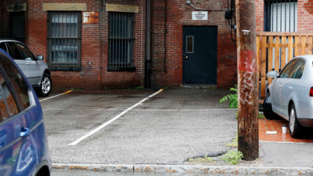
A parking garage in D.C.
On Tuesday, the District’s top planning official defended her office’s ideas at a D.C. Council hearing, part of the ongoing Zoning Regulations Review that has involved nearly 50 public hearings and meetings since 2008. The Office of Planning is expected to hand its voluminous proposals to the Zoning Commission by the end of the month, triggering another lengthy public process.
Under the new proposal, developers would no longer be required to construct a minimum number of parking spaces in new apartment housing, office, and retail space in downtown D.C., near Metro rail stations, and in busy bus corridors. Office of Planning Director Harriet Tregoning told council members that the current rules are outdated, prescribing a one-size-fits-all approach that does not reflect driving and parking demand in individual neighborhoods.
“The current code can’t look at the household rate of car ownership in a neighborhood. It can’t look at the type of people who are being marketed to for a particular building,” said Tregoning. “It is one-size-fits-all now, so the proposed changes are to make it possible for the parking in a given building to more closely resemble the anticipated demand in that place, in that building, in that neighborhood.”
Eliminating mandatory parking minimums would not mean developers would cease building any parking spaces at all, Tregoning said.
“Should the Zoning Commission approve changes to parking requirements the projects are likely to deliver more than what is minimally required and explicitly be sensitive to market demand,” she said.
Tregoning pointed to Census data that show 38.5 percent of D.C. households are car-free, and roughly half of all trips are taken with transit, on foot, or by bicycle. In her view, mandatory parking minimums often lead to the construction of excessive, unused spaces. The Coalition for Smarter Growth, a group that supports the changes, contends that the construction of parking spaces drives up housing costs an average 12.5 percent per unit.
Data under dispute
Opponents testified that the elimination of parking minimums would force drivers to circle their neighborhoods looking for spaces. Despite efforts to reduce car dependency, the number of vehicles in the District is increasing, they said.
“There were 267,000 vehicles in D.C. in 2009. 285,000 registered in 2012. So we have a very significant question. What is D.C.’s comprehensive approach to parking? Is this our plan?” said Judy Chesser, one of several residents who testified against the parking proposals. “[The Office of Planning] has demonstrated their lack of data by insisting for many months that car ownership was being reduced in D.C. while it was increasing.”
Lobbyists for AAA Mid-Atlantic, whose officials have accused Washington of waging war on cars, told council members the proposed overhaul of parking rules threatens the District’s future because visitors will choose to stay away if they can’t find parking.
“This situation will worsen if new apartment buildings, stores and offices are built without garages or parking spaces,” said AAA’s Lon Anderson. “The Office of Planning’s logic is that if parking is scarce and driving difficult we will attract fewer cars. But that also means we will attract fewer people.”
Developers near transit stations and in downtown D.C. may favor a change in current policy because of the enormous cost of constructing underground parking, estimated at $40,000 to $70,000 per space, according to Tregoning’s office.
Learning lessons from out west
In Portland, Oregon, officials in April reversed changes to the city’s parking rules after eliminating mandatory minimums, a development frequently cited during the hearing by Tregoning’s critics. Portland reinstated minimums for apartment dwellings with more than 30 units, although developers may reduce by half the parking requirement by providing more bicycle parking and spaces for bike- and car-sharing services.
In 2012 Portland commissioned a study that found “that 64 percent of residents are getting to work via a non-single-occupant vehicle. Almost a third (28 percent) of those surveyed belonged to car-free households; however, cars are still the preferred mode of travel for many of the survey respondents.”
About two-thirds of the vehicle owners surveyed in Portland’s inner neighborhoods “park on the street without a permit and have to walk less than two minutes to reach their place of residence, and they spend only five minutes or less searching for a parking spot,” the study found.
The Office of Planning is targeting July 29 to hand its proposed zoning changes to the Zoning Commission.
Photo courtesy of AlbinoFlea on flickr.
Community stories show the shift to a walkable lifestyle
38 percent. That’s the growing percentage of District households that are car-free. Countless others are car-lite, relying mostly on transit, walking, and biking.
Too often we lose sight of this fact in local debates on issues like parking, transit improvements, redevelopment, and so on.

")
.")


, so we never have to wait long. And we never have to look for parking, because we don't need any! Our apartment costs more than one in the suburbs would, but we don't have a car payment, nor an insurance payment, nor any gasoline bills. We do occasionally rent cars for out-of-town trips, but that's much less hassle and cost than car ownership.'")


Mouse over or click an image to read an individual story.
Basic lifestyle and mobility decisions are fundamentally changing for large segments of DC’s population. Nonetheless, a significant number of District policies and discussions still assume that most residents will own a car and use it for many, if not all, of their daily needs.
The consequences of this misunderstanding impact all of us, ranging from higher housing costs, increased traffic thanks to unintentional subsidy of car ownership, and diverting resources from improving other transportation options.
In the end, what all of that means is a less walkable, less inclusive District.
To raise awareness of this misunderstanding, the Coalition for Smarter Growth has collected first-hand accounts from neighbors across DC, examining the various modes of transportation they use in their everyday lives.

Click for interactive map.
We hope this project will help policy makers and skeptical (but open-minded) residents understand that the District won’t face parking and driving Armageddon if we respond to changing lifestyle choices by getting rid of unnecessary parking mandates for new buildings, or by giving buses more priority on roads to make transit more reliable and convenient.
The District won’t face that Armageddon because so many existing residents and new residents simply don’t drive very much. Tastes and lifestyle choices are in the midst of a dramatic change, and despite what some hyperbolic opponents of transportation havesaid, a majority of our new residents are very likely to be car-free or car-lite and looking to stay that way.
. We chose our neighborhood for its walkability and its proximity to transit and shopping, and the opening of the Green Line and the retail that came with it made it even more convenient. For services not in our neighborhood, we prefer to patronize those that are in transit-accessible locations and have had no trouble finding them. Our car sits in the garage for the rare occasion when we need it (it's 20 years old with very low mileage for its age and runs like new).'")
, run errands, and meet friends. Sometimes I use Car2Go to get home after a dinner on H St. or bring groceries home. Most of my shopping happens along the Metro lines between work and home. Throughout the day, I probably end up collectively walking about 1-2 miles. Aside from a more active daily routine, not having a car expense has created a better cash flow, allowing me to make some decent investments and to have more cash on hand each month to enjoy our fair city.'")
, walking, and the hassle of parking, there was no need for a car in the city. Nearly 2 years ago, I got a job that was based in Tyson's Corner which, to my dismay, I needed a car for. There's a reason that I originally sold my car when I moved to the city, so when I had to buy another one, I quickly remembered why owning one was such a hassle; traffic, parking, maintenance, and constant fear of your car being bumped/scratched everytime someone parallel parks. Luckily, I was able to transfer to Rosslyn three months ago and now have a short walk to the Circulator bus and then a short Metro ride from there. It's so great not having to worry about traffic/bad drivers and just to be able to read a book in peace during my commute everyday. My car mostly sits idle on the street these days, and I love it.'")


: no crowding, no worrying about finding a parking spot, no traffic jams, no full buses. Also, it's free, although I go through shoes faster than I used to. When I go to external meetings for work I take the bus, Metro, walk, Bikeshare, taxi, or Car2Go: whatever is convenient for where I'm coming from and going to. I use the same mix when traveling to social activities. I live a block away from a grocery store, so I just walk there and carry my groceries back. If I'm going out of town or need to haul something heavy I'll rent a car, either from traditional car rentals like Enterprise or carsharing like Zipcar or Hertz on Demand. So my average car 'budget' is probably about $50 a month - with no registration, parking sticker, maintenance, and so on.'")
, or Car2Go. The bus stop is right outside of my house, and I can get most anywhere in the city to pick up groceries, shop, go to work, or even pick up a couple of 2x4s from Home Depot! Though I love a good bus ride, Car2Go has to be one of the best inventions for us urbanites. Like I said, I live in a really car-dependent area, so sometimes having a vehicle is necessary to get places when I'm running late or it's late at night. While I can say that my house in Fort Totten is more walkable than my parent's house in the suburbs, it could be a lot better. DC has done a really good job in terms of providing different options, but those options need to be available for everyone across the city!'")
Mouse over or click an image to read an individual story.
Abstract statistics and shouting matches about who is right aren’t what walkable living is all about. Instead, it’s just regular people throughout the city who are leading this quiet but growing sea-change, that’s making much of our 20th century transportation formulas less relevant to how we get around today:
- Longtime resident Wanda in Hillbrook notes how many of her neighbors walk to the stores along Minnesota Avenue, and pleads for more investment in pedestrian and bike infrastructure in her neighborhood.
- Rebecca in Petworth happily relies on Metro to drop her toddler off at daycare in L’Enfant Plaza, and walks to the grocery store to do her family’s shopping.
- In Mt. Vernon Square, Keith says that on the rare occasions when he can’t walk to where he’s going, Car2Go, Bikeshare, or transit is there to fill the gap.
If you have time, please use our story collection form on the Walkable Living Stories campaign webpage to share your own story, and consider tweeting or sharing your favorite story on Facebook.
If you have other ideas to help explain this changing lifestyle preference to policy makers, neighbors, or the press, leave them for us in the comments section, or share them with the Coalition for Smarter Growth directly at action@smartergrowth.net.
My walkable living story
Almost 4 in 10 DC households are car-free, and even more are car-light. That’s not because DC is full of car-hating zealots; it’s because life is simply more convenient that way, when the conditions are right.
When 5 minutes of walking, along a pleasant and safe sidewalk, can get you to most of your daily needs, and cycling or high-frequency transit can get to the rest, driving is more of pain than convenience. Especially when you factor in battling for parking and road rage, not to mention cost.
So when the Coalition for Smarter Growth started putting together Walkable Living Stories, about how and why so many DC residents go car-free or car-light, I wanted to participate. Here’s my story:

“My wife and I hate sitting in traffic and wanted to never have to do it again. So we opted out! When we selected our apartment, we intentionally picked one in the densest part of DC. Within two blocks of our apartment we have a grocery store, convenience mart, dry-cleaner, hardware store, and several cafes. So almost all our daily errands are on foot, or Capital Bikeshare. My commute is on the 16th St. bus line, where buses come every few minutes (more often than Metro trains!), so we never have to wait long. And we never have to look for parking, because we don’t need any! Our apartment costs more than one in the suburbs would, but we don’t have a car payment, nor an insurance payment, nor any gasoline bills. We do occasionally rent cars for out-of-town trips, but that’s much less hassle and cost than car ownership.”
For more about CSG’s Walkable Living Stories project, visit their website, or see today’s big GGW post.
Click here to read the original story in BeyondDC >>
Click here to read the original story in The Washington Post>>