 FAIRFAX, Va. – At the first of two Northern Virginia Transportation Authority public hearings Thursday, about 100 people showed up at Fairfax City’s city hall to discuss the best way to improve commutes.
Specifically, the NVTA wanted to get advice on how to spend about $192.5 million that will come from new taxes in Virginia Gov. Bob McDonnell’s transportation package, which takes effect July 1.
“While we want to work quickly, we also want to make sure we spend these dollars wisely,” said NVTA Chairman Martin Nohe, who also serves on the Prince William County Board of Supervisors.
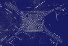
The authority released a long list of projects, broken down into six corridors, with detailed descriptions of costs and congestion relief projections.
Delegate Jim LeMunyon, a Republican who represents part of Fairfax and Loudoun counties, handed out maps to NVTA members with red, yellow and green lines to describe congestion in Northern Virginia.
“In my view, the priority of the authority is to get the red off the map. It’s as simple as that,” he said.
But Stewart Schwartz, executive director of the Coalition for Smarter Growth, testified that LeMunyon’s approach is too focused on cars and not enough on transit.
“The misguided approach of just trying to get the red out by widening roads and adding interchanges is only going to squander our tax dollars,” he said.
Schwartz advocates policies that promote sustainable communities where people can eat, work and play in one spot. He urged NVTA members to fund mass transit options that will solve congestion problems in the long term.
Several citizens who testified seemed to agree with this approach.
“Move the rail projects to the top of the list. Give them the highest priority because they’ll do the most good for the most people,” said Alexandria resident Gail Parker.
“When you’re looking at projects that are efficient, an automobile that’s only carrying one person is not a very efficient mode of transportation,” said Fairfax City resident Douglas Stewart.
Schwartz says constantly widening roads also could convince drivers to abandon carpools and go back to single-occupancy vehicles, which he says is a bad idea.
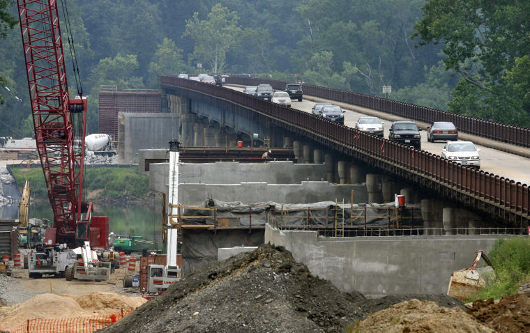
However, several residents also pointed to Route 28 projects as a good use of transportation dollars.
“Route 28 connects western Prince William to Fairfax and Loudoun and there are several shovel-ready projects that are just awaiting money and could help with congestion relief,” said Nohe.
Kerry O’Brien of Fairfax County is familiar with traffic on the roadway.
“Route 28 is severely congested during the rush hours now. Relief is needed now. It’s not needed in 2035, it’s needed now,” he said.
Jeff Fairfield of the Route 28 Station – South Study Working Group applauded the efforts.
“These projects are shovel-ready. The final designs are ready. The right-of-way has been secured. The construction contracts are ready to go,” he said.
But Jeanine Lawson of Prince William County urged caution.
“I ask you to closely scrutinize the project for widening Route 28 from Linton Hall Road to Fitzwater Drive. That road is on the border of Fauquier County, which isn’t covered in this tax, so I question why you’d do it. The money would be better spent in the Yorkshire section,” she said.
Lawson was referring to a particularly congested stretch of Route 28 on the Prince William County and Fairfax County border between Manassas and Centreville.
Nohe believes both the Linton Hall Road and Yorkshire projects could get money this year.
Currently, the list contains 12 road and 21 transit projects. LeMunyon wants NVTA members to reduce the list to three or four, but Nohe tells WTOP he thinks the final approval list will have 10 to 15 projects.
The NVTA will hold a second public hearing on July 24 at 6 p.m. at Fairfax City’s city hall, then hold a meeting where a few projects could get the green light.
Two more open houses will be held next week:
- Fairfax County
Date: June 26th
Time: 7:00 p.m.
Location: Fairfax County Government Center, 12000 Government Center Parkway, Rooms 4/5, Fairfax, Virginia. - Arlington County
Date: June 27, 2013
Time: 6:00 pm
Location: Arlington County Board Room 300, 2100 Clarendon Boulevard Arlington, Virginia 22201
Photo courtesy of WTOP/Ari Ashe.
Click here to read the original story>>


")
.")


, so we never have to wait long. And we never have to look for parking, because we don't need any! Our apartment costs more than one in the suburbs would, but we don't have a car payment, nor an insurance payment, nor any gasoline bills. We do occasionally rent cars for out-of-town trips, but that's much less hassle and cost than car ownership.'")


. We chose our neighborhood for its walkability and its proximity to transit and shopping, and the opening of the Green Line and the retail that came with it made it even more convenient. For services not in our neighborhood, we prefer to patronize those that are in transit-accessible locations and have had no trouble finding them. Our car sits in the garage for the rare occasion when we need it (it's 20 years old with very low mileage for its age and runs like new).'")
, run errands, and meet friends. Sometimes I use Car2Go to get home after a dinner on H St. or bring groceries home. Most of my shopping happens along the Metro lines between work and home. Throughout the day, I probably end up collectively walking about 1-2 miles. Aside from a more active daily routine, not having a car expense has created a better cash flow, allowing me to make some decent investments and to have more cash on hand each month to enjoy our fair city.'")
, walking, and the hassle of parking, there was no need for a car in the city. Nearly 2 years ago, I got a job that was based in Tyson's Corner which, to my dismay, I needed a car for. There's a reason that I originally sold my car when I moved to the city, so when I had to buy another one, I quickly remembered why owning one was such a hassle; traffic, parking, maintenance, and constant fear of your car being bumped/scratched everytime someone parallel parks. Luckily, I was able to transfer to Rosslyn three months ago and now have a short walk to the Circulator bus and then a short Metro ride from there. It's so great not having to worry about traffic/bad drivers and just to be able to read a book in peace during my commute everyday. My car mostly sits idle on the street these days, and I love it.'")


: no crowding, no worrying about finding a parking spot, no traffic jams, no full buses. Also, it's free, although I go through shoes faster than I used to. When I go to external meetings for work I take the bus, Metro, walk, Bikeshare, taxi, or Car2Go: whatever is convenient for where I'm coming from and going to. I use the same mix when traveling to social activities. I live a block away from a grocery store, so I just walk there and carry my groceries back. If I'm going out of town or need to haul something heavy I'll rent a car, either from traditional car rentals like Enterprise or carsharing like Zipcar or Hertz on Demand. So my average car 'budget' is probably about $50 a month - with no registration, parking sticker, maintenance, and so on.'")
, or Car2Go. The bus stop is right outside of my house, and I can get most anywhere in the city to pick up groceries, shop, go to work, or even pick up a couple of 2x4s from Home Depot! Though I love a good bus ride, Car2Go has to be one of the best inventions for us urbanites. Like I said, I live in a really car-dependent area, so sometimes having a vehicle is necessary to get places when I'm running late or it's late at night. While I can say that my house in Fort Totten is more walkable than my parent's house in the suburbs, it could be a lot better. DC has done a really good job in terms of providing different options, but those options need to be available for everyone across the city!'")


