 The first major re-write of Washington’s zoning code since it was established in 1958 is expected to be submitted by the Office of Planning today, ending six years of work and triggering another lengthy public process before the District’s Zoning Commission, which will have the final say on new zoning policies.
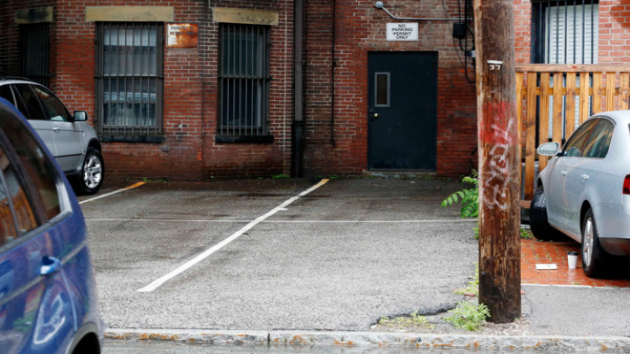
Among the most controversial proposals is the effort to make D.C. less car-dependent by eliminating mandatory off-street parking space minimums in new development in downtown D.C. Planning Director Harriet Tregoning had also proposed to eliminate parking minimums in transit corridors, but recently changed her position to only reduce those minimums.
Tregoning’s change has left advocates on both sides of the debate unhappy.
“We’re encouraged that there’s not going to be an absolute rule that there will be no parking minimums. We think that’s a step in the right direction, but we are still very concerned because the planning director of the District of Columbia has shown her hand. She, for whatever reason, does not believe there is a parking issue throughout much of the District,” said AAA MidAtlantic spokesman Lon Anderson.
“We are disappointed the city has listened to the opposition to progressive reforms and is backing down on the important reform of removing parking minimums in areas that are well served by transit. The proposal would address a number of the biggest problems with parking minimums but we still maintain that parking minimums are not the right approach to building a more affordable, sustainable city,” said Cheryl Cort, the policy director for the Coalition for Smarter Growth.
At the heart of the controversy lies the question: how much parking does a growing, thriving city need as developers continue to erect new housing, office and retail space near Metro stations, in bus corridors, and downtown D.C. The alleged scarcity of parking spaces today is a common complaint of motorists, but those who favor dumping the parking minimums say residents and visitors will have adequate alternatives to automobile ownership, like car-sharing services, Metro rail and bus, and Capital Bikeshare. Smart growth advocates also point out developers will still be able to build parking if the market demands it, but the decision will be left to them, not decided by a mandate.
“We’re building a lot of parking that generates a lot of traffic, undermining the best use of our transit system,” Cort said.
“We spent the last 100 years building our society to be automobile dependent and then to try to change that in a very short period of time is really imposing an awful lot in a region that is still very, very dependent on the automobile,” counters Anderson.
About 38 percent of all D.C. households are car-free, according to U.S. Census data.
Photo courtesy of AP Photo/Michael Dwyer. Copyright 2013 by WMAL.com. All rights reserved.


")
.")


, so we never have to wait long. And we never have to look for parking, because we don't need any! Our apartment costs more than one in the suburbs would, but we don't have a car payment, nor an insurance payment, nor any gasoline bills. We do occasionally rent cars for out-of-town trips, but that's much less hassle and cost than car ownership.'")


. We chose our neighborhood for its walkability and its proximity to transit and shopping, and the opening of the Green Line and the retail that came with it made it even more convenient. For services not in our neighborhood, we prefer to patronize those that are in transit-accessible locations and have had no trouble finding them. Our car sits in the garage for the rare occasion when we need it (it's 20 years old with very low mileage for its age and runs like new).'")
, run errands, and meet friends. Sometimes I use Car2Go to get home after a dinner on H St. or bring groceries home. Most of my shopping happens along the Metro lines between work and home. Throughout the day, I probably end up collectively walking about 1-2 miles. Aside from a more active daily routine, not having a car expense has created a better cash flow, allowing me to make some decent investments and to have more cash on hand each month to enjoy our fair city.'")
, walking, and the hassle of parking, there was no need for a car in the city. Nearly 2 years ago, I got a job that was based in Tyson's Corner which, to my dismay, I needed a car for. There's a reason that I originally sold my car when I moved to the city, so when I had to buy another one, I quickly remembered why owning one was such a hassle; traffic, parking, maintenance, and constant fear of your car being bumped/scratched everytime someone parallel parks. Luckily, I was able to transfer to Rosslyn three months ago and now have a short walk to the Circulator bus and then a short Metro ride from there. It's so great not having to worry about traffic/bad drivers and just to be able to read a book in peace during my commute everyday. My car mostly sits idle on the street these days, and I love it.'")


: no crowding, no worrying about finding a parking spot, no traffic jams, no full buses. Also, it's free, although I go through shoes faster than I used to. When I go to external meetings for work I take the bus, Metro, walk, Bikeshare, taxi, or Car2Go: whatever is convenient for where I'm coming from and going to. I use the same mix when traveling to social activities. I live a block away from a grocery store, so I just walk there and carry my groceries back. If I'm going out of town or need to haul something heavy I'll rent a car, either from traditional car rentals like Enterprise or carsharing like Zipcar or Hertz on Demand. So my average car 'budget' is probably about $50 a month - with no registration, parking sticker, maintenance, and so on.'")
, or Car2Go. The bus stop is right outside of my house, and I can get most anywhere in the city to pick up groceries, shop, go to work, or even pick up a couple of 2x4s from Home Depot! Though I love a good bus ride, Car2Go has to be one of the best inventions for us urbanites. Like I said, I live in a really car-dependent area, so sometimes having a vehicle is necessary to get places when I'm running late or it's late at night. While I can say that my house in Fort Totten is more walkable than my parent's house in the suburbs, it could be a lot better. DC has done a really good job in terms of providing different options, but those options need to be available for everyone across the city!'")


