Author: Cheryl Cort

MD 214/Central Ave. safety workshop comments (Prince George’s)

MD 214/Central Ave. safety workshop comments (Prince George’s)

RE: MD 214/Central Ave. 12/10/24 safety workshop comments

TO: Mulowa K. Kajoba, Maryland State Highway Administration (SHA) Project Manager, mkajoba@mdot.maryland.gov

FROM: Cheryl Cort, Policy Director, Coalition for Smarter Growth

DATE: December 16, 2024

Dear Project Manager Kajoba: 

Thank you for holding a public input workshop regarding MD 214/Central Avenue. We have been working with community members in this corridor for several years. We are excited to see important safety measures be contemplated by SHA. We are hopeful that they can be implemented as soon as possible, taking advantage of quick build low cost solutions.

Regarding the MD 214 12/10/24 display boards “Improvement Opportunities,” we wish to add some comments to this excellent list. Overall, we hope to see retrofits that create a 30 MPH design speed/operating speed roadway, which is the posted speed limit in portions of the corridor. A design speed of 30 MPH better reflects the Metro station local center designation by the County’s General Plan, and better utilizes the state’s investment in the Metrorail system. 

  • Construct missing sidewalk – Yes, and Old Central Av. at Zelma should be closed.
  • Tighten curb radii – All intersections should be assessed for tighter turns (15′ turning radius standard or 25’ effective radii for truck/bus routes), and driveways can be narrowed or closed across public ROW too. These and other measures should narrow crossing distances and slow vehicle speeds to benefit pedestrians.
  • Remove channelized turn lanes or improve sight distance for pedestrians and drivers – Yes, closing off slip lanes would be a big help for pedestrians, and slow vehicle operating speeds.
  • Add new signals or pedestrian hybrid beacons – Yes — Cabin Branch Rd should be a top priority for a new signal, but should be done with travelway narrowing and other measures to slow operating speeds to ensure compliance with the signal and posted speed limit of 30 MPH (near Cabin Branch Road). 
  • Implement road diet to add buffered bike lanes – Yes, the traffic volume of 30,000 vehicles/day does not justify a six lane roadway, thus the oversized road encourages drivers to greatly exceed the posted speed limit of 30 MPH. This urban area — by 2 Metro stations, a high school, local businesses should have an urban roadway designed to encourage slower, safe operating speeds and safe, easy crossings for people walking, biking and riding transit. A road diet configuring the roadway for four rather than six lanes is sufficient to address vehicular traffic. 

Further, travel lane widths can be narrowed consistent with PG DPW&T’s Urban Street Design Standards of 10’ for general lanes and 11’ bus routes. 

We support a buffered bike lane as a good use of the excess space, however these lanes should be vertically separated to ensure both safety for cyclists and visually narrowing of the roadway to reduce operating speeds to safe levels. The new AASHTO Guide for the Development of Bicycle Facilities can help address the most appropriate design to match this high-volume location. Interim, less expensive protected bike lane elements that can be deployed quickly should be done as soon as possible to improve roadway safety, followed by more expensive permanent measures. 

Better walking conditions created by buffered bike lane: We note that a buffered bike lane will also improve the safety and comfort for people walking along the road. In our walk audit of Central Avenue, Central High School students identified the discomfort of walking on a sidewalk next to high speed traffic as a problem, and also occasional vegetation or standing water as a partial obstruction of sidewalks and crossings, and narrowness of some sidewalk segments. 

  • Provide bus stop connectivity – Yes, this is a problem in several places along the corridor but is acute for students who ride the bus to and from Central High School. SHA should make a special effort to solve for safe access for these students, and other bus stop users. 
  • Provide bus stop amenities [my addition] — add a bench and shelter to the Cabin Branch Rd stops. If SHA does not normally do this, it should work with agencies like MTA to install facilities to give students and other bus riders a more comfortable trip. 
  • Replace and upgrade signs – yes, and look at ways to consolidate, narrow and close driveways unnecessarily intruding on the public sidewalk and roadway creating extra or elongated conflict points. 
  • Add lighting – yes.

Making Capitol Heights more bike friendly: Establishing protected bike lanes to Central Ave. will greatly enhance bike connectivity in the corridor. The Central Ave. Connector Trail will also do this, but is not in conflict with bike lanes on Central Ave. Repurposing travel lanes to bike lanes is a good way to improve safety for drivers, bikers & pedestrians. 

Quick build, low cost, tactical measures: Many interventions can be done quickly at low cost but deliver big benefits to safety, and can even lower maintenance costs over time. Given the budget constraints faced by Maryland, deploying low cost tactical measures within months or the next year will have major benefits to safety and support transit-oriented development. As more funding is available, more permanent retrofits can be implemented. Other jurisdictions often use this approach – quick build temporary safety measures right away, followed by more expensive permanent elements later.

Thank you for the opportunity to comment. Please keep us informed as this important project moves forward.

Testimony: Emergency Rental Assistance Reform Amendment Act of 2024 (Support, DC)

We ask the DC Council to support the Emergency Rental Assistance Reform Amendment Act (B25-994) to avert a crisis driven by unprecedented levels of unpaid rent. The bill would ensure that DC law establishes the right incentives to bring tenants and housing providers together to save and stabilize at-risk housing to serve low income DC residents.

Tips for testifying in support of an inclusive neighborhood

Tips for testifying in support of an inclusive neighborhood

This is your guide to testifying virtually at the DC Zoning Commission for:

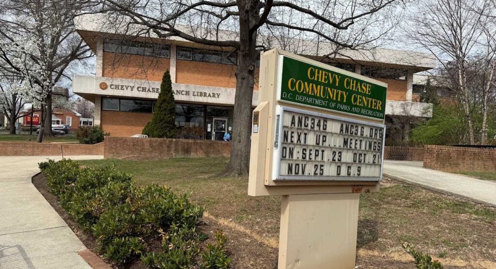
Case No. 23-02: Chevy Chase Neighborhood Mixed Use Zones on April 29, 2024 at 4pm

How to sign up to testify:

In order to testify at the hearing, you MUST sign up to testify at least 24 hours in advance of the hearing date.

  • Sign up to testify virtually by April 28 at 4pm at https://dcoz.dc.gov/service/sign-testify 
  • To sign up you need to search for the hearing date — April 29, state that you are a “proponent” and swear to tell the truth. 
  • Submit written comments (if you haven’t already sent a letter) in advance of the hearing date. Send an email of your comments to zcsubmissions@dc.gov
  • Note: The hearing is 100% virtual. There is no in-person testimony. You can either call or appear on video for your testimony. 

What to expect when testifying

  • After signing up to testify, you will be sent a link from the D.C. Office of Zoning with the information to log in to view the hearing, and testify when your name is called. 
  • On April 29, the hearing will start at 4pm, but plan on 5pm to start with proponents’ testimony. At 4pm, the Zoning Commission will discuss preliminary matters, and hear a presentation from the DC Office of Planning. It’s possible that this case could require several public hearings and will not hear from all proponents at the first hearing date. 
  • Your testimony:
    • Prepare to speak for three minutes. 
    • State that you generally support what’s being proposed. If you want to make suggestions for how something can be better, be sure to always declare your overall support, and then say you have recommendations to make it even better. 
    • Always be polite and formal, and only speak for your allotted 3 minutes. 
    • It’s a formal proceeding but the commissioners are very respectful of all the people who make the effort to testify and they generally listen attentively to what you have to say and occasionally have a question for you.

View our full tips for testifying guide:

For more background information, check out our Chevy Chase Zoning Explainer.

EVENT: Branch Ave Metro tour and placemaking meetup, Oct. 3, 2023

Connectivity + placemaking: Unlocking development around transit at the Branch Av. Metro station, with RISE Prince George’s.

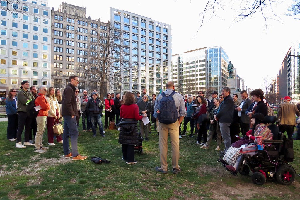
On Oct. 3, 2023, in collaboration with RISE Prince George’s, we explored Prince George’s effort to focus future growth within the beltway and established communities by taking a look at the Branch Avenue Metro station area. We were welcomed by District 8 Council Member Ed Burroughs, III. Following the Council Member, we discussed Metro station area planning and development, zoning, street design, and walk and bike access. We then walked to Apollo Restaurant Row and convened a panel discussion on Prince George’s emerging placemaking initiatives.

Resources: 

The Capital Market Turnip Tour

WMATA Joint Development 10-Year Strategic Plan

Downtowns Are Changing, but ‘Haven’t Plateaued Yet’

Premium grocery stores are missing from the region’s high-income Black neighborhoods

Brittney Drakeford, urban planner, speaks to the group about creative placemaking. Pictured: District 8 Council Member Ed Burroughs, in the middle facing the group.

CSG Testimony in Support of Providence Hospital redevelopment

CSG Testimony in Support of Providence Hospital redevelopment

September 29, 2023

Attorney General Brian Schwalb, District of Columbia 

400 6th Street, NW, Washington, DC 20001

RE: Providence Hospital – Support for mixed income housing and parks at former hospital site

Dear Attorney General Schwab::

Please accept this letter on behalf of the Coalition for Smarter Growth (CSG). CSG is the leading non-profit organization in the Washington, D.C. region, including DC and suburban Maryland, dedicated to making the case for smart growth. Our mission is to promote walkable, inclusive, and transit-oriented communities, and the land use and transportation policies and investments needed to make those communities flourish.

We are writing to express our support for the proposed sale and redevelopment of the Providence Hospital site. We support the re-purposing of the now closed Providence Hospital with mixed income housing, parks and other amenities. 

Specifically, we support the preliminary redevelopment plans for the 22-acre site to build about 450 townhouses and apartments. We are especially supportive of at least 20 percent of these homes as affordable, including family-sized townhouses. This would total about 90 rental and ownership affordable homes. 

The development agreement exchanges the value of land for the high cost of demolition of the nine-story hospital building, with additional subsidies anticipated for the affordable homes. This is a reasonable agreement for the addition of affordable, mixed income homes at this site, along with community amenities. 

The proposed redevelopment will provide a mix of greenspaces and playspace, along with other community benefits. This mix of new homes and greenspaces is well-located between the Fort Totten and Brookland Metro stations, and other public amenities like Turkey Thicket and many schools. 

We look forward to supporting the refinement of this proposal as it advances through the development review process. 

Thank you for your consideration.  

Sincerely,

Cheryl Cort, Policy Director

CSG comments on Brookland-CUA Metro station proposed changes to transit facilities

CSG comments on Brookland-CUA Metro station proposed changes to transit facilities

September 22, 2023

by Cheryl Cort, Policy Director, Coalition for Smarter Growth

Please accept this testimony on behalf of the Coalition for Smarter Growth, the leading organization advocating for walkable, bikeable, inclusive, transit-oriented communities as the most sustainable and equitable way for the Washington, DC region to grow and provide opportunities for all. 

The suburban-style Brookland Metro station has long been in need of a makeover. At the same time, DC needs more housing and affordable housing, especially around transit hubs. Offering more housing opportunities in this highly accessible location will benefit the many families and individuals who would like to live in a walkable, bike-friendly, transit-accessible neighborhood. 

While the proposed changes offer a much better station area than today, given the severe constraints on the development parcels and continued dominance of bus bays, we ask that WMATA further reconsider the site layout to achieve the full potential of this redevelopment.

Currently, much of the east side of the station area is covered in expansive bus bays and a short-term parking lot. The proposed changes can help recreate a more urban, pedestrian-scaled layout and knit the station back into the fabric of the community. 

 We see the following as positive outcomes of the proposed transit facilities changes:

  • Reducing the impervious surface area
  • Reconfiguring bus bays into transit streets along an extended Newton Street and 9th Streets
  • Creating a more walk-friendly environment with a new street grid
  • Reducing the number of  Kiss and Ride spaces and relocating the remaining spaces to curbside spaces under the Michigan Avenue bridge, which is already informally used for drop off/pick up due to its proximity to the station entrance
  • Maintaining the nine bus bays, and adding new layover space
  • Freeing up space for new apartments and retail

Below, we discuss several issues that can help improve the station area as a part of this process.

Rethinking bus bays, transit streets, & bus terminus: The illustration of the reconfigured bus bays shows the sawtooth curb design. We request consideration of a straight curb line, parallel bus bay/stop design for off-street or possibly on-street bus stops. We recognize the major improvement from the vast bus bay island and driveway configuration of today, but we ask that further consideration be given to street and bus facility designs that provide a more comfortable pedestrian environment for people walking and waiting for buses, and how these facilities are integrated into the fabric of the street network.

Given the modest number of bus transfers at the station, we recommend WMATA consider several changes to bus service terminating at Brookland station. We ask that bus routes discharge and pick up passengers near the station entrance, but layover somewhere else. Or instead of terminating at the station, run service on reconfigured streets close to the station entrance. These changes could shrink the amount of space dedicated to bus layovers, and improve the pedestrian environment. 

Buildable parcels: We are concerned that the three sites proposed for mixed use development are severely constrained and offer inefficient building layouts that would generate high construction costs, and limited accessibility for loading, deliveries and drop off. We ask WMATA to reconsider the street design, bus facilities and plaza to create a more pedestrian-friendly environment and one that provides more efficient and feasible building footprints. 

Public spaces and plazas: We recommend that the project require the inclusion of vibrant, interactive public spaces around the Metro station entrance. The public space should be welcoming for transit riders and offer places for sitting, shade, public art, improved wayfinding, room for vendor kiosks or other close connections between people at the station and convenience retail. 

Park amenities and connection to Brooks Mansion (DC owned, occupied by DCTV):  The RFP for future development can ask for park amenities for both the preserved greenspace next to the Metro parking lot and the Brooks Mansion grounds (such as benches and climbable art) to be provided and maintained as a part of a larger mixed use development. We ask that WMATA work with the District government to revise the current (underutilized) use of the Brooks Mansion property. The Brooks Mansion should be repurposed as a civic building and accessible public garden, and the fencing removed or modified, and surface parking lots removed. Members of the public have called for preserving and increasing green space at the Metro station. Opening up these large grounds are an ideal use of this open space to meet the desire for additional usable greenspace. 

Housing and affordable housing: The site should be reconfigured to maximize the potential for mixed income housing. We know that the joint development needs to pay for the new transit facilities, and then pay for important amenities like affordable housing, public spaces, park furniture, and maintenance. We ask that affordable housing be a top priority. Affordable housing is a critical need and the Inclusionary Zoning set aside is automatically 20% for the parcels zoned PDR, an industrial zone. We think this is a good baseline for the RFP but also support the use of city incentives such as tax abatements to help the project pay for affordable housing, along with other costs. 

Bicycle access and facilities: The redevelopment of the station should incorporate enhanced bicycle facilities, including secure bicycle storage, station access, and connections to the Metropolitan Branch Trail. 

Bunker Hill Road & 10th intersection: We ask that the Bunker Hill and 10th Street intersection be redesigned to reduce crossing distances for pedestrians and improve safety. We note that no buses appear to be routed to turn right exiting the station on Bunker Hill Road, so reduced crossing distances should not be a conflict with major transit vehicle movements. 

A competitive RFP: We encourage WMATA to set up a competitive RFP that leverages the value of the site so that redevelopment can pay for priorities like affordable housing, dynamic public spaces, better bike and walk facilities, and park amenities. To realize these opportunities, we urge WMATA to do further assessment of how to replace bus bays, and bus service at the station, and create feasible development parcels for housing or mixed use development. 

These priorities, which meet regional, citywide and local community goals should be incorporated into the RFP process. Affordable housing is especially expensive and desperately needed. Therefore, we urge WMATA, in cooperation with the District, to ensure that we maximize affordable housing opportunities at the site as a part of an overall project that creates great public spaces and increased bus, walk, and bicycle access. 

We look forward to working with the community, local officials, and WMATA to shape future development plans to add new mixed income homes, shops, public spaces, improved walk and bicycle access, and better bus connections. 

Thank you for the opportunity to comment.

CSG Testimony in Support of the Walkable Urban Streets Act

CSG Testimony in Support of the Walkable Urban Streets Act

September 8, 2023

Council Member Eric Olson

Chair, Transportation, Infrastructure, Energy and Environment Committee (TIEE)

Prince George’s County Council

Wayne K. Curry Administration Bldg., 1301 McCormick Drive, 2nd Floor, Largo, MD 20774

Dear Chair Olson:

Please accept this letter on behalf of the Coalition for Smarter Growth (CSG). CSG is the leading non-profit organization in the Washington, D.C. region dedicated to making the case for smart growth. Our mission is to promote walkable, inclusive, and transit-oriented communities, and the land use and transportation policies and investments needed to make those communities flourish. 

Thank you for introducing the Walkable Urban Streets Act, and our thanks as well to the eight co-sponsors. We are enthusiastic supporters of the Walkable Urban Streets Act, Council Bill 69-2023 and its companion resolutions CR 67-2023 and CR 68-2023. 

This legislation updates and codifies DPW&T’s 2017 Urban Street Design Standards. These standards are to be applied to Regional Transit Districts and Local Centers as designated in Plan 2035. They will help build safer streets, especially for people walking and biking, and they will support transit-oriented development, a major priority of Prince George’s County. 

The legislation is greatly needed for two reasons. First, the county’s roads are dangerous because they are too wide and too high speed. Fast, wide roads generate more severe crashes and the county leads the DC region in traffic and pedestrian deaths. The second reason to adopt this legislation is because walkable, bike-friendly street designs are necessary for high-quality and competitive transit-oriented development. 

Despite prior adoption of the 2017 Urban Street Design Standards, DPIE and DPW&T have not taken advantage of opportunities to create the kinds of safer, vibrant, walkable, transit-oriented streets and places envisioned in Plan Prince George’s 2035. In fact, the streets in and near transit centers have remained overly-wide, fueling high speed traffic, making the roads dangerous for all users – people walking, bicycling, riding transit, and driving. For specific examples, see our companion fact sheet: Examples of urban street projects falling short of the 2017 standards.

One key reason is that the county’s traffic models often overpredict future traffic volumes, and do not adequately account for the increased walking, biking, and transit use in transit-oriented communities. Designing only for projected vehicle travel becomes a self-fulfilling prophecy.  The wider and faster the road, the less inviting it is for people walking, biking or taking transit, and  the more driving it attracts.

This approach gives priority to speed over safety. It also undermines the economic development that occurs in a place where cars are slower and people want to be – the walkable, mixed-use, transit-accessible centers of activity that have been so successful in other parts of the region. In fact, some congestion is an indicator of a successful local economy.  Plan 2035 recognizes this and the county’s transportation review standards allow for an urban level of traffic volumes on streets around mixed use transit centers and a focus on improving access by means other than driving.

The updated Urban Street Design Standards proposed in this bill require safer streets around transit districts and local centers, and include these components:

  • 25 mph design speed maximum
  • 2-4 travel lanes total roadway maximum
  • 10′ travel lane widths (11′ for bus routes)
  • 15′ corner radii (and no slip lanes/high speed turn lanes)
  • Buffered walk and bike facilities 
  • On-street vehicle parking with bulbouts (where appropriate)

The Walkable Urban Streets Act will ensure the county is planning and building the streets needed for improved safety, people-oriented places, and economic success.

Thank you for your consideration. 

Sincerely,

Cheryl Cort

Policy Director